if you feel bore and want to relax
Enjoy www.afcgame.com

Showing posts with label GPS. Show all posts

Thursday, May 19, 2011

Always Greener Golf GPS v1.10

Always Greener Golf GPS v1.10 | Read more...
Description
Slow play is the golfers arch enemy and Always Greener certainly doesn't want to add to the problem. When on the course you need yardages at a glance. Realistically you are not going to use your gps for every shot and therefore we have tried to keep to the essentials. Your not going to find course flyovers, tracking of bets, scores (its quicker with a pencil) and scrolling of google maps. Just yardages quickly when you need them. If you do need a yardage other than the flag you can switch to the map view. To help you quickly get the yardage required we ensure that the entire hole is visible on the map. We have no zoom or scroll function as downloading the extra pieces of the map takes time. As mobile phone screens are longer vertically it makes sense that the hole is rotated to use all the available space. To obtain a yardage at a glance we ensure that the green is always at the top of the screen.

GPS Sport Tracker v1.90

GPS Sport Tracker v1.90 | Read more...
Description
GPS Sport Tracker is a FREE small usefull program designed for anyone who enjoys cycling, mountain biking, skiing, running, hiking or walking. The software provides realtime statistic like current speed, altitude, distance, etc. and data for post analysis using PC.

GPS Sport Tracker Main Features:

1) Speed (current, average, max.), time to pass 1 km (1 mi)
2) Altitude (current, total up, total down)
3) Distance
4) Heading
5) Metric and imperial units
6) Time, elapsed time, simple lap timer
7) Track view with zoom in, zoom out, center start position, center current position
8) Offline maps, different renders available
9) Elevation profile, points where max speed, max and min altitude were achived
10) GPS signal availability, satellite info, settings for accuracy
11) Simple waypoints, waypoints with a photo, latitude and longitude can be printed on the picture
12) Save track, export track in GPX and KML format. Log is also available when battery dies
13) Loading saved tracks (GST, GPX), using saved tracks as a background track
14) Extended power management, program lock
15) Bearing back to anchor, absolute and relative bearing, anchor alarm
16) Available in several languages
Version 1.9.0

New features:
- Export in KML format

Monday, December 6, 2010

GPS2day v1.11

GPS2day v1.11 | Read more...
Price: Free

Description
GPS2day is a today screen plug-in showing your current GPS coordinates, speed, satellite info, etc...
Languages: English, Chinese, Czech, Dutch, French, German, Hungarian, Italian, Japanese, Polish, Portuguese, Russian, Serbian, Spanish.

Currently GPS2day program works as GPS informer. It supports both metric and U.S. (Imperial) units and shows a various types of information for users, such as:
Current geographical coordinates (latitude, longitude);
Course and speed;
Some information about satellites and fix type;
Altitude followed by the fix 3D value;
Exact current date and time from the satellite atomic clock;
And battery life state which is important when you using GPS device.

Version 1.0.11 Changes:
- This update adds support for Chinese and Portuguese languages;

Version 1.0.10 Changes:
- Translations to the Serbian, both Cyrillic and Latin were added;
- Fixed some bugs, related to the minor memory leaks.

Version 1.0.9 Changes:
- Translations to the Czech and Japanese were added;
- Sound alert when fix from the satellites is obtained.

Monday, November 15, 2010

GPS Sport Tracker v1.80

GPS Sport Tracker v1.80 | Read more...
Description
GPS Sport Tracker is a FREE small usefull program designed for anyone who enjoys cycling, mountain biking, skiing, running, hiking or walking. The software provides realtime statistic like current speed, altitude, distance, etc. and data for post analysis using PC.

GPS Sport Tracker Main Features:

1) Speed (current, average, max.), time to pass 1 km (1 mi)
2) Altitude (current, total up, total down)
3) Distance
4) Heading
5) Metric and imperial units
6) Time, elapsed time, simple lap timer
7) Track view with zoom in, zoom out, center start position, center current position
8) Offline maps, different renders available
9) Elevation profile, points where max speed, max and min altitude were achived
10) GPS signal availability, satellite info, settings for accuracy
11) Simple waypoints, waypoints with a photo, latitude and longitude can be printed on the picture
12) Save track, export track in GPX format. Log is also available when battery dies
13) Loading saved tracks (GST, GPX), using saved tracks as a backgorund track
14) Extended power management, program lock
15) Bearing back to the anchor, anchor alarm, absolute and relative bearing
15) Translations
Version 1.8.0
New features:
- Editing of waypoints
- Absolute and relative bearing to an anchor
- Minor bug fixes

Saturday, October 16, 2010

WIMP - Where Is My Phone v1.4.0

WIMP - Where Is My Phone v1.4.0 | Read more...
Price: Free

Description
In the event of your phone being lost or stolen, you can simply send a specially formatted SMS text message to the phone and the W.I.M.P software will silently intercept it. W.I.M.P. will then send back a message containing the phone's GPS location in a format which can be entered into any common mapping application.

OK - so someone steals your phone. What is the first thing they're going to do? Change the SIM card right? The W.I.M.P. application will automatically detect a change in the SIM card and send you a text message containing the new number. You can then use that number to track the device's location or even ring the phone!

W.I.M.P. will always run covertly in the background, it will even automatically start when you reset the phone ensuring it is always protected.

Features
Runs silently and covertly in the background. It doesn't even show in the list of running programs.
Will send your phone's GPS coordinates via text message, allowing you to accurately track your phone's location using any common mapping application (e.g. http://maps.google.com)
If the SIM card is replaced on the phone, it will automatically send a text message informing you of the new number.

Requirements : Windows Mobile 5 or 6 Phone, Internal GPS (it will work with an external GPS device, but obviously only when connected)

Friday, October 1, 2010

GPS Sport Tracker v1.70

GPS Sport Tracker v1.70 | Read more...
Price: Free

Description
GPS Sport Tracker is a FREE small usefull program designed for anyone who enjoys cycling, mountain biking, skiing, running, hiking or walking. The software provides realtime statistic like current speed, altitude, distance, etc. and data for post analysis using PC.

GPS Sport Tracker Main Features:

1) Speed (current, average, max.), time to pass 1 km (1 mi)
2) Altitude (current, total up, total down)
3) Distance
4) Heading
5) Metric and imperial units
6) Time, elapsed time, simple lap timer
7) Track view with zoom in, zoom out, center start position, center current position
8) Offline maps, different renders available
9) Elevation profile, points where max speed, max and min altitude were achived
10) GPS signal availability, satellite info, settings for accuracy
11) Simple waypoints, waypoints with a photo, latitude and longitude can be printed on the picture
12) Save track, export track in GPX format. Log is also available when battery dies
13) Loading saved tracks (GST, GPX), using saved tracks as a backgorund track
14) Extended power management, program lock
15) Bearing back to the anchor, anchor alarm
15) Translations
What is new in version 1.7.0:
New features:
- New map cache structure
- Added a tool for converting old map cache into a new one
- You can add waypoints manually
- Minor bug fixes

Thursday, August 19, 2010

Mobbyway v1.18

Mobbyway v1.18 | Read more...
Price: Free

Description
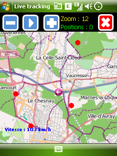
- Avertisseur des radars fixes et mobiles - Géolocalisation par vos proches ou vos amis de votre position sur une carte par un système d'invitation disponible sur votre mobile. - Retour possible sur vos parcours de 15 derniers jours - Statistiques détaillées de vos parcours (vitesse moyenne, nombre de Km ..) - Information de circulation (Bouchons et accidents) - Contribution au projet OpenStreetMap - Live tracking Processus d'installation : 1 - Installer le .CAB 2 - Lancer Mobbyway 3 - Dans le menu, Enregistrement : Enregistrez vous 4 - Dans le menu parametres : Selectionner le port COM de votre GPS (Pour HD2, choisissez COM4) et valider les autres parametres 5 - Relancer Mobbyway. Votre activation de compte sera effectuée dans les 5 minutes suivantes. Si à l'issue de cette durée votre compte n'était pas activé, nous vous invitons à contacter le support à l'adresse support@mobbyway.com Pour toute question , vous pouvez consulter la FAQ : http://www.mobbyway.com/FAQ.html Mobbyway has been developed to allow - Stay connected with loved ones or whatever the place they are - Allowing your family to track your movements in real time and visually - Allow you to return at any moment on a trip that you made in a given date. - To move safely on the road network through the network of members: Mobbynautes - Contribute to the global mapping OpenStreetMap

Tuesday, August 10, 2010

GPS Sport Tracker v1.60

GPS Sport Tracker v1.60 | Read more...
Price: Free

Description
GPS Sport Tracker is a FREE small usefull program designed for anyone who enjoys cycling, mountain biking, skiing, running, hiking or walking. The software provides realtime statistic like current speed, altitude, distance, etc. and data for post analysis using PC.

GPS Sport Tracker Main Features:

1) Speed (current, average, max.), time to pass 1 km (1 mi)
2) Altitude (current, total up, total down)
3) Distance
4) Heading
5) Metric and imperial units
6) Time, elapsed time, simple lap timer
7) Track view with zoom in, zoom out, center start position, center current position
8) Offline maps, different renders available
9) Elevation profile, points where max speed, max and min altitude were achived
10) GPS signal availability, satellite info, settings for accuracy
11) Simple waypoints, waypoints with a photo, latitude and longitude can be printed on the picture
12) Save track, export track in GPX format. Log is also available when battery dies
13) Loading saved tracks (GST, GPX), using saved tracks as a backgorund track
14) Extended power management, program lock
15) Bearing back to the anchor, anchor alarm
15) Translations
What is new in version 1.6.0:
New features:
- GPS can be switched on/off
- Added Google Maps render
- Minor bug fixes

Monday, August 9, 2010

Deluxe Moon v1.23

Deluxe Moon v1.23 | Read more...
Price: Free

Description
Deluxe Moon opens you an unique possibility to look closer at how the moon influences on your life. Depending on your location the application shows you such an interesting things like the current moon phase, Zodiac sign, moonrise and moonset times and many other parameters.

The Moon is our closest celestial neighbor and the most prominent object in the night sky.

Although the Moon is so much smaller than the Sun, it strongly affects everything on the Earth, including many aspects of your life. Not only tides and animals are affected by the Moon, but also it influences human emotions, relationships, blood pressure an even finances.

Many forms of life on Earth depend on the Moon movement. If you keep track of it, you will soon discover some amazing relationships. This knowledge could help you make your life better!

We would like to offer you the tool to discover more about the influence of the Moon, your mobile assistant which is always at your service wherever you are.

Enjoy our Deluxe Moon application and save money: it is completely free.


Deluxe Moon Features

* Visual picture of the moon phases and the percent of the illuminated area.
* Full names of all moon phases.
* Zodiac Sign the moon is in.
* Current moon’s age: how far along the moon is in its full cycle.
* Moonrise and moonset times for your location.
* Amount of time from moonrise and to moonset.
* Calculations for the current and other dates.
* Network independence: you can work anywhere in the world without Internet or cellular connections.
* Your current location determined by GPS
* Cellular network positioning can be enabled for several types of devices

Requirements:
WindowsMobile 5.0+
.NET Compact Framework 3.5
Screen resolutions:
QVGA (240x320), HVGA (320x480), VGA (480x640), WVGA (480x800).
*Compatible with:
Square 240x240, WQVGA (240x400), Square 320x320, SquareVGA 480x480

Sunday, August 8, 2010

WinSportsTracker v2.21

WinSportsTracker v2.21 | Read more...
Price: Free

Description
WinSportsTracker
is an intuitive easy to use application with powerful capabilities for touch screen Windows mobile professional phones. It is for everyone who enjoy outdoor sport activities like running, cycling, skiing, sailing, riding, hiking, rollerblading...It logs your activity speed, distance, altitude, position and many more and show on dashboard, graph or map (up to 7 views). You can save track logs for later review or export on PC (view on Google Earth, etc). WinSportsTracker helps you to improve your performance in sports. It will not affect normal operation of your mobile phone during use.

Why buy expensive sport tracking gear if you can install FREE program on your windows mobile phone?

Main program features:

* Up to 7 different tracking views
* Display speed (current, average, max, graph display)
* Display altitude (current, total up, total down, min, max, graph display)
* Speed/pace switch
* Display distance
* Display duration
* Lap timer (lap statistic)
* Auto lap
* manual pause / auto pause
* Display GPS coordinate
* Graphic display speed and altitude vs. time, altitude display relative or absolute
* Graphic display speed and altitude vs. distance, altitude display relative or absolute
* Track view on map
* Offline maps
* Support different activities (running, cycling, skiing, riding, sailing,...)
* Measuring units: metric, imperial, nautical
* Normal/full screen mode
* Slide display, scroll list
* Power management – long battery life
* GPS signal info (satellites, signal strength)
* Auto save track in case if battery runs out
* History of tracks
* Lock display on/off
* Light display on/off
* Export track in GPX format (you can view track in Google Maps or some different app.)
* Support Windows mobile 6.5 professional resolutions: WVGA, VGA, square, WQVGA, QVGA, portrait and landscape orientations

Thursday, August 5, 2010

ReliRescue GPS v1.17

ReliRescue GPS v1.17 | Read more...
Price: Free

Description
ReliRescue enables your Windows Mobile Phone to broadcast your location to designated partners (over SMS or email).
Your location is obtained using Integrated or external (Bluetooth) GPS connected to your device.
This utility also enables any Windows Mobile platform to feed the broadcasted waypoints to track and locate the sender.
I use this utility to broadcast my location during Hang Gliding activities to a ground personal (Reli - the software is named after you...).
This Utility is provided for free (as long as it seems), however contains a time expiration mechanism so you'd come again to get a newer version from this site. Features of this current version (partial list):
  • Supports internal GPS or external Bluetooth GPS.
  • Supports Smartphone versions of Windows Mobile
  • Supports location broadcast over your Phone's SMS (Short Message Service).
  • Status display: Speed, Alt, Destination to WP, Time to WP, SMS status and more...
  • Supports recording a compressed track log
  • Data features:
    • Connecting to the Internet through GPRS/UMTS/WiFi/USB
    • Sending compressed track log to an email receiver.
    • Translation of track log to Google KML (screen shot, sample KMZ file) and FAI IGC formats by server side (which sends email)
  • SMS Broadcast features:
    • Supports livetrack update
    • Supports broadcast to multiple phone numbers
    • Supports periodic interval broadcasts (5, 10, 30 ... minutes)
    • Supports reducing the amount of sent SMS messages by sending them only if you are on the move.
    • Supports automatic detection of "landing/crash" situation and sends a message.
    • Records a log of sent messages, so you'd know how many messages were sent and get their status.
  • New:
    • Supports gpx file format for wapoint storage
    • Supports interception of SMS messages sent from r3d party trackers. this is useful for tracking buddies with diffrent devices
    • Power saving option to maximize battery life
    • Fault tolerance: Cell tower detection and retry operation
    • Night display, for seekers driving by night
    • Automatic Broadcast notification on Low battery - useful to find your phone if lost...
    • Responds query SMS with pass code (ex. "R$0000")


Requirements:
.NET CF 2.0

Mobbyway v1.17

Mobbyway v1.17 | Read more...
Price: Free

Description
- Avertisseur des radars fixes et mobiles - Géolocalisation par vos proches ou vos amis de votre position sur une carte par un système d'invitation disponible sur votre mobile. - Retour possible sur vos parcours de 15 derniers jours - Statistiques détaillées de vos parcours (vitesse moyenne, nombre de Km ..) - Information de circulation (Bouchons et accidents) - Contribution au projet OpenStreetMap - Live tracking Processus d'installation : 1 - Installer le .CAB 2 - Lancer Mobbyway 3 - Dans le menu, Enregistrement : Enregistrez vous 4 - Dans le menu parametres : Selectionner le port COM de votre GPS (Pour HD2, choisissez COM4) et valider les autres parametres 5 - Relancer Mobbyway. Votre activation de compte sera effectuée dans les 5 minutes suivantes. Si à l'issue de cette durée votre compte n'était pas activé, nous vous invitons à contacter le support à l'adresse support@mobbyway.com Pour toute question , vous pouvez consulter la FAQ : http://www.mobbyway.com/FAQ.html Mobbyway has been developed to allow - Stay connected with loved ones or whatever the place they are - Allowing your family to track your movements in real time and visually - Allow you to return at any moment on a trip that you made in a given date. - To move safely on the road network through the network of members: Mobbynautes - Contribute to the global mapping OpenStreetMap

Tuesday, August 3, 2010

JGUI LOC VISUALIZER v3.0

JGUI LOC VISUALIZER v3.0 | Read more...
Decription
Exporting geographic location received from some external GPS Locator (Tracker),directly to map image in your Windows Mobile phones.

If you use some kind of location tracker, or GPS locator, or phone with GPS, to save your children, car, or dog...the one which sends you an SMS messages with known geographic location,so... in this situations, LOC.VISUALIZER is the program you need.

It saves the received location(s), and displays automatically on Google® Mobile Maps free program,or Tomtom® Navigator, or Microsoft® Live Search, in any Windows Mobile phone (both in Professional and Standard Winmo, smartphone versions).

What you need:
1. Some kind of GPS tracker, also named: locator, with function of sending SMS with location
2.1. Windows Mobile phone, with free Google® Mobile Maps installed
2.2. or Windows Mobile phone, with free Microsoft® Live Search installed
2.3. or Windows Mobile phone, with Tomtom® Navigator installed
3. LOC.VISUALIZER installed

Requirements : WM5.WM6

Joggah v1.4.0

Joggah v1.4.0 | Read more...
Description
Running log with integrated GPS tracker.

With Joggah you always have your complete running log book with you on your mobile device. Using the integrated GPS tracker functionality you can record your running tracks straight to your log automatically. Of course you can still listen to music or place phone calls simultaneously while Joggah tracks your outdoor workout. As each running path is stored in standard KML format, they can be opened directly in Google Earth.

Features

· Keeps a detailed log book of all your training exercises.
· Integrated GPS tracker records your outdoor fitness activities including distance, time, speed, pace, calories burned, and path traveled.
· Realtime display of speed and total distance covered based on GPS data.
· Simple finger based touch screen operation.
· Touch screen lock and button lock prevent unintentional operation while exercising.
· Various speed, pace, and distance units supported (miles, kilometers, etc.)
· Easily track jogging shoe mileage.
· Give it a personal touch by setting your own background picture.
· Storage of calories burned and training effect for each log book entry makes it ideal for a long term collection of the log book information from a Suunto heart rate monitor.
· GPS track is stored in standard KML format for easy viewing in Google Earth and similar applications.
· The log book is stored in convenient tab-separated-values format that allows direct opening in Microsoft Excel or other spread sheet applications.

Requirements : Windows Mobile 5/6.x, .NET Compact Framework 2.0

Friday, July 30, 2010

ESymetric Run.GPS Trainer UV PRO v.2.3.7b

Price: Free

Description
This allows you to define your personal training plans: import and export training plans & synchronize your training plan with Microsoft Outlook.

Allows you to create your personal training plans:
* plan your training units with the following parameters:
* sport
* time of day
* frequency (once, daily or weekly)
* distance
* duration
* average speed
* intensity
* minimum and maximum heart rate
* import and export training plans
* synchronize your training plan with Microsoft Pocket Outlook

What's new in Run.GPS Trainer UV 2.3.7b.build.2070 (07-Jul-2010):
* new sports icons
* separate version for Android 1.6 (Android market filters application though minSDK is set to 4) (Android version)
* support for Bluetooth heart rate monitor connectivity on all Android 2.0 and higher platforms (there have been Bluetooth connection problems on some platforms)

Requirements : WM5.WM6

Mirror 1

ESymetric Run.GPS Trainer UV PRO v.2.3.7b

ESymetric Run.GPS Trainer UV PRO v.2.3.7b | Read more...
Description
This allows you to define your personal training plans: import and export training plans & synchronize your training plan with Microsoft Outlook.

Allows you to create your personal training plans:
* plan your training units with the following parameters:
* sport
* time of day
* frequency (once, daily or weekly)
* distance
* duration
* average speed
* intensity
* minimum and maximum heart rate
* import and export training plans
* synchronize your training plan with Microsoft Pocket Outlook

What's new in Run.GPS Trainer UV 2.3.7b.build.2070 (07-Jul-2010):
* new sports icons
* separate version for Android 1.6 (Android market filters application though minSDK is set to 4) (Android version)
* support for Bluetooth heart rate monitor connectivity on all Android 2.0 and higher platforms (there have been Bluetooth connection problems on some platforms)

Requirements : WM5.WM6

Thursday, July 29, 2010

GPSSpot v1.1.6

GPSSpot v1.1.6 | Read more...
Description
Using GpsSpot you can easily save any location and using the built-in or attached GPS device the application will show you at what distance and in what direction the saved spot is.

You don't know where you parked your car anymore? Have you ever wondered how far your are away from home and in what direction it is? The GpsSpot application uses the built-in or attached GPS device to show in what direction and how far a previously saved spot is.

Using GpsSpot you can easily save any location and using the built-in or attached GPS device the application will show you at what distance and in what direction the saved spot is. Without any difficulties you will find every saved spot again, like your parking space, your bicycle in front of yesterdays bar, the next cash machine or bus stop.

Features:
· Finger friendly handling without using the stylus.
· Saving the current location with just two finger taps.
· Prevent the device from going to stand-by while the application is running.
· Displays the distance in meter or miles/yards.
· The direction arrow can also be displayed in a high-contrast color for a good perceptibility even on bright day light.
· All currently common device resolutions are supported by GpsSpot.
· It is possible to switch the language of the application between English and German.

What's New in This Release:
New functions:
Acoustic signal on first reception of coordinates.

Requirements : Pocket PC with WM 5.0, 6.x

Saturday, June 19, 2010

GPS Sport Tracker v1.50

GPS Sport Tracker v1.50 | Read more...
Price: Free

Description
GPS Sport Tracker is a FREE small usefull program designed for anyone who enjoys cycling, mountain biking, skiing, running, hiking or walking. The software provides realtime statistic like current speed, altitude, distance, etc. and data for post analysis using PC.

GPS Sport Tracker Main Features:

1) Speed (current, average, max.), time to pass 1 km (1 mi)
2) Altitude (current, total up, total down)
3) Distance
4) Heading
5) Metric and imperial units
6) Time, elapsed time, simple lap timer
7) Track view with zoom in, zoom out, center start position, center current position
8) Offline maps, different renders available
9) Elevation profile, points where max speed, max and min altitude were achived
10) GPS signal availability, satellite info, settings for accuracy
11) Simple waypoints, waypoints with a photo, latitude and longitude can be printed on the picture
12) Save track, export track in GPX format. Log is also available when battery dies
13) Loading saved tracks (GST, GPX), using saved tracks as a backgorund track
14) Extended power management, program lock
15) Bearing back to the anchor, anchor alarm
15) Translations
What is new in version 1.5.0:
New features:
- Waypoints editing
- Preview picture waypoints
- Minor design changes

Requirements:
Windows Mobile Pocket PC 6, 6.1
.NET Compact Framework 3.5

Friday, June 18, 2010

MobileTraveler v2.50

MobileTraveler v2.50 | Read more...
Price: Free

Description
Version 2.5.3817.33583 True fingerfriendly GPS routing software with voice with routing functionality using google and cloudmade and tile downloading from google, microsoft and openstreetmap. So not only googlemaps and not only openstreetmap but best of 3 leading internet map providers. Be sure to have a new mobile6.5 phone or download dotNETCF3.5 before using it.

All pda/phones except WinMo6.5 which is shipped with dotNETCF3.5 require dotNetCF3.5 installed on the phone. See http://www.mobiletraveler.nl where you can find it and how it can be installed on your phone.
It is only possible to use MobileTraveler on windows mobile5.0, 5.1, 6.0,6.1,6.5 TOUCH SCREEN devices. It must be installed on a storage card and at least 20 megabyte of free RAM memory is needed.

Requirements:
Windows Mobile Pocket PC 5 , 6 , 6.1, 6.5

Wednesday, June 16, 2010

Runsat v1.15

Runsat v1.15 | Read more...
Price: Free

Description
runsat is the GPS sports application for cycling, running, skating, skiing, and beyond. runsat features:
  • Time and distance tracking
  • Autopause
  • Auto lap (auto waypoint) recording
  • Manual lap recording
  • Integrated sports photography
  • Map display
  • including offline cacheing of maps
  • Chart display - speed and elevation
  • Multiple settings for multiple sports
  • Training Diary – including lap, map, photo and chart review
  • Integration with runsaturday online training log and analysis tools - KML and GPX track export
Requirements:
Windows Mobile Pocket PC 5 , 6 , 6.1 - touch screen and GPS required - Net CF 2.0 required